Koh Lanta
July 13, 2009 by admin
Filed under Attractions


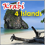
 Koh Lanta, 68 km from Krabi town, has a group of 52 islands, the largest of which are Koh Lanta Yai, Koh Lanta Noi and Koh Klarng. ‘Pulaotatak’ is the original name for Koh Lanta. In the language of the Chao Ley sea gypsies, it means simply ‘island with long beach’. The Chao Ley have a long history of living in Koh Lanta. Although many Chao Ley today seem to live no differently from the ethnic Thais on Lant, they proudly keep alive some traditions, such as the celebration of ‘Loy Rua Chao Le’ (The setting adrift of the Chao Ley boats). Visitors wanting to learn more about the Chao Ley sea
  gypsies and their traditions should take a look at the village of Sangaua on the southernmost tip of Koh Lanta Yai’s West coast. Koh Lanta Yai’s geography consists mainly of limestone mountain, with the Lanta Range running through the middle of the island. It is covered in lush rainforest, home to many species of fauna and flora. The magnificent beaches of the West coast draw increasingly more travellers in search of rest and recreation. The sub-district of Saladan on Koh Lanta Yai is the center of tourist facilities. Some of the most popular activities on Koh Lanta are swimming, sunbathing, cave exploration and scuba diving.
Lovely People of Krabi
July 9, 2009 by admin
Filed under Attractions
 In the past, a great number of foreigners, such as Egyptians, Romans, Arabs, Indians and Chinese, stopped at the sea port of Krabi during their long voyages. The exchange which took place was not only commercial, but also cultural. It was in this way, that Krabi developed a charming character of its own.
CULTURE BLENDING
The result of 3,000 to 5,000 years of pleasant cultural blending can be plainly seen in the character of the local people today. Krabi people are typically bold, assertive, open, direct, trustful and above all welcoming to strangers.
Than Bokoranee National Park
July 9, 2009 by admin
Filed under Attractions
Than Bok Khorani National Park


 General Information
Than Bok Khorani National Park is a rainforest situated in the valley in the midst of the mountains. Streams flow through the area disappearing into the limestone rocks underneath the mountains, on their journey to the sea.
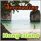
Krabi Hong Islands
July 9, 2009 by admin
Filed under Attractions
 The lovely blue and green sea surrounding the Hong Islands is a kayakker’s wonderland.
HIGHLIGHTS OF THE HONG ISLANDS
LAO PI LEH BAY
The beach is right in front of Hong Island. The shade of cliff and trees enhance this pure-white, powdery beach to be a recreational place for most adventures.
Poda Islands
July 9, 2009 by admin
Filed under Attractions
Poda Island
8 km West of Ao Nang, this small group of islands has a natural landmark in Chicken Island’s limestone rock, resembling a chicken’s head and neck. At the back of the island, you can find yourself in an underwater world of brilliantly coloured marine life.

Locals refer to this as Poda Nok Island (Koh Darm Kwan). At low tide it is possible to walk along a connecting beach or sandbank from Chicken Island to Mor Island.
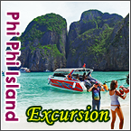
Koh Phi Phi’s Group of Islands
July 5, 2009 by admin
Filed under Attractions
Phi Phi Island : The Chao Ley sea gypsies named the islands Pulaopi are pi. Pulao means island and pi is a kind of tree or samae. The island group lies 42 km from the mainland of Krabi and is composed of 6 islands : Phi Phi Don Island, Phi Phi Ley Island, Bida Nork Island, Bida Nai Island, Mosquito Island and Bamboo Island.

MOSQUITO ISLAND
Lies to the North of Phi Phi Don Island. It is the least visited of all the local islands, with very little beach land, but is not lacking in underwater attractions, as testified by the visits of dive operators.
Krabi’s Dive Sites
July 3, 2009 by admin
Filed under Attractions
Scuba diving in Krabi is to be found at over 60 sites in the three main areas of Ao Nang’s islands, Phi Phi Island and Hin Daeng. Conveniently, their respective distances from Krabi town serve to indicate the grade of dive.
Around Krabi Town
June 28, 2009 by admin
Filed under Attractions
With its situation on the estuary, Krabi has been a commercial town from the past to the present, but with different purposes and businesses. Those appearing now are mostly part of Krabi’s tourist centre to the many spectacular islands in the Andaman Sea. The size and shape of sea-going vessels have also changed from large ships used in trading to the relatively smaller passenger boats used in the tourist industry.

Krabi Early History
June 26, 2009 by admin
Filed under Attractions
Krabi is one of Thailand’s oldest historical sites with evidence reflecting to this day, what it once had been.
 27,000 – 37,000 years ago the primate ancestors of prehistoric man inhabited the area. Their remains are believed to have been discovered by archaeologists in Nuerklong’s lignite mine.
EARLY EVIDENCE
Scientific proof of the migration of primitive man and wall paintings in cave sites of Krabi and Phang Nga show that those sites had been settled in by prehistoric man. As for the early cave painting depicting symbolic image of land and marine creatures in black, red and brown, estimates of their age vary at between 3,000 and 5,000 years old.
Krabi Geography
June 25, 2009 by admin
Filed under Attractions

Twenty years ago, Krabi River, Krabi Town. Photo courtesy of Morag Mckerron.
Located on the western shore of the central Indochina peninsular, where the Andaman Sea lies adjacent, Krabi is blessed with plains, mountains, valleys, rainforest, mangroves, rivers, caves and islands. The coastline of Krabi is 160 km. long. It lies between a latitude of 7′ 30″ and 8′ 30″ North and a longtitude of between 98′ 30″ and 99′ 30″ East. To the North : lie the provinces of Phang Nga and Surat Thani. To the South : lie the province of Trang and the Andaman Sea. To the East : lie the provinces of Trang and Nakorn Sri Thammarat. To the West : lie the province pf Phang Nga and the Andaman Sea. Area : The province of Krabi covers an area of 4709 square km. divided into 8 districts ; Muang, Khao Phanom, Klong Tom, Plai Praya, Koh Lanta, Ao Luk, Lum Thab and Nuerklong.